


2021 Lough Conn Spiranthes coast:
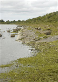
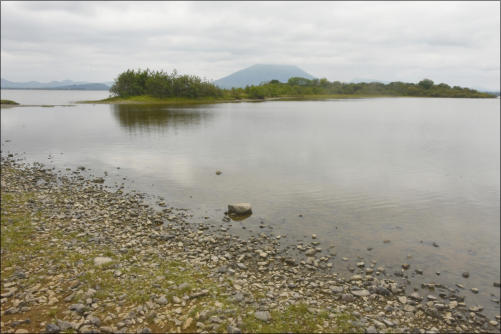
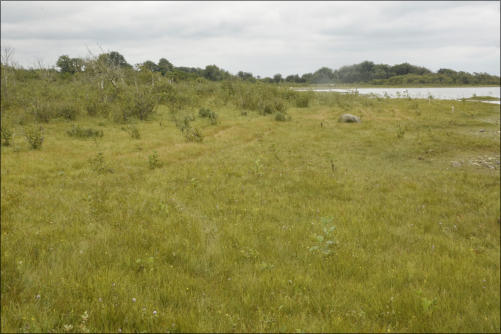
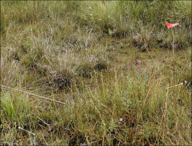
One of the most attractive other rarities found in this area — apart from the orchid Spiranthes romanzoffiana — is a happy group of Red-breasted Mergansers (ABOVE) with her brood of 7, leaving the shoreline in the background to seek safety on the open water as we approach during the start of this year’s surveying on the west shore of L. Conn. The shoreline shown behind the ducks used to be a very popular area for the deposition and growth of Spiranthes romanzoffiana. However recent Winters have been very wet and very stormy and the shoreline seen this year is markedly different from previous years with a sandy grassy shore replaced with a much wider and significantly stony shoreline. The stones range in size from heavy cobbles (30cm +) to numerous smaller boulders and pebbles. The area Spiranthes seedlings used to establish themselves is now more stony than grassy and not an attractive site for the orchid. Any seed washed ashore will be washed away by the outgoing wave..Existing orchids from several years back may now be buried under heavy stones and no longer able to emerge? But this was our first day here and maybe more will be found in later rounds? (Final Surveys up to mid August show no improvement! But, other areas have compensated)


Survey Title:
Irish Lady’s Tresses Survey 2021
Survey No.:
21romz/1 - 13
Species:
Spiranthes romanzoffiana
Location:
Lough Cullin and Conn, Co Mayo
Description:
Regular annual survey of these twin lakes
Date from/to:
5th July 2021 - 12 September 2021
LINKS to similar work: See previous years our SiteMap
Do join us! We have a big area to cover and help or support from Local Farmers, Landowners or keen Naturalists particularly from the surrounding area — would be very welcome and Help Save Biodiversity David (086 3900731) Frances (086 8162447
DIARY Ref. No:
DAY and DATE
LOCATION
Weather
Water Level
SUMMARY
TOTAL SEEN
21romz/1a
Mon 5th July 1100-1530
Drummin and NE Bay, Cullin
Drizzle then Dry
P 0.39 low
None seen at Car Pks. Emerging in Bay
15
21romz/1b
do. 1545 -1700
East shore Lr. Massbrook Bay, Conn
Shore fully searched; none today.
-
Early Detection:
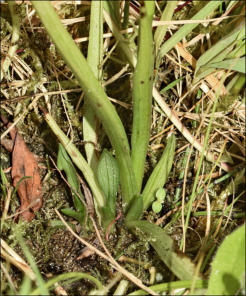
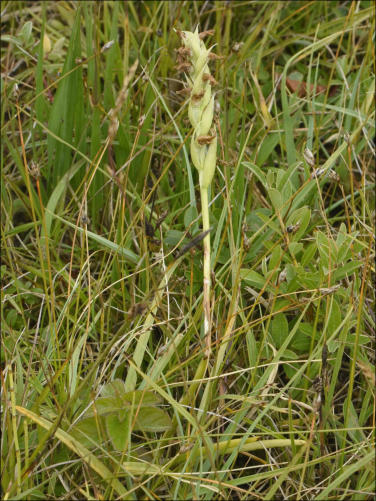
First plant of the season, very small, hidden in low vegetation, only found after
detailed search of the habitat. This was a grassy bank on the shoreline at the NE
corner of L. Cullin. A few others were seen in this area.
These plants are hard to detect at this stage but it is made easier by experience of
their favourite places — such as we have over 5 years in this area. They also
normally have significantly yellower long thin leaves. The bud often has a paler
softer green than surrounding vegetation and this bud, even when small, has a
very characteristic appearance and uniform colour. i.e there is no white or red
(Marsh Orchids) showing in the developing flower. Plants without buds (rare) are
almost impossible to detect at this stage.
LEFT: Main area for early flowering S. romanzoffiana:
This specimen was one of a group occurring in a small island of rocks,
sand and stubby trees (mainly Bog Myrtle), that provide them with the
substrate and shelter to allow initial plants to germinate and then
survive for many more years.
This image shows a more visible specimen and the typical sandy areas
between boulders and vegetation. A group of 4 ‘family’ Spiranthes
survived here for 5 years and now a pair of ‘twins’ is recurring for its
third year. The bare sand and low level vegetation makes these plants
easier to see and record. Similarly areas of flat flooded grassland
(popular with Spiranthes) also make the plants easier to detect.
However, in many locations S. romanzoffiana choses to grow in rough
margins with dense overgrowth and these areas need to be searched
carefully at this time of year to ensure that hidden specimens are found.
REF 21=Year, romz=species, No.=stage of survey, Level P= Pontoon (Cullin); C=Corrosla (Conn)
a) North East Bay Lough Cullin Car Park 1 (south):
A quick visit here on the way to Nephin and the west shore of L. Conn. It was great to see a large number of
specimens emerging. (This was the site where, last year, inadvertent damage was caused on the site.) 32
specimens were recorded in a very short time with a considerable possibility that these numbers may increase
naturally or decrease through people pressure. However, the NPWS and Coillte are aware of the issue and no
further cutting will take place in the area.
DIARY Ref. No:
DAY and DATE
LOCATION
Weather
Water Level
SUMMARY
TOTAL SEEN
21romz/3a
Tues 20th July 0700-0800
NE Cullin, 1st Car Park (South)
Mild bright.
P 0.40 low
Recount. Very good numbers emerging, Quiet.
59
21romz/3b
do. 0800-0900
SE corner Knockmore, L.Conn
Sunny
C 0.26
Good count. Recovering but grazed.
18
21romz/3c
do. 0915-1000
Knockmore Bay N and W
Bright and calm
do.
Grazed land leading to stony shore and island.
22
21romz/3d
do. 1015-1050
Sandy Bay beach
Calm and Hot
do.
Dry and hot on beach. Spiranthes still missing!
0
21romz/3e
do. 1050-1130
Headland N of Sandy Bay
Fresh and hot near water.
do.
Karst shore site, regular, hard to find.
10
DIARY Ref. No:
DAY and DATE
LOCATION
Weather
Water Level
SUMMARY
TOTAL SEEN
21romz/2a
Thur 15th July 0930 - 1000
NE Cullin, 1st Car Park (South)
Misty, cool.
P 0.29 low
Good numbers emerging, location quiet.
32
21romz/2b
do. 1100-1430 (D)
Massbrook, W Conn to Headland
Bright and calm
C.
Bad; shore stony plants seen emergent only
2
21romz/2c
do. 1200-1430 (F)
Mass/Cuilkillew N of headland
do.
do.
Plants present small numbers.
4


a) NE Cullin, 1st Car Park.
Starting off with a new assistant, our Son, with a very early start and finish due to heatwave like conditions that made it
hard to stay out in the open after noon! The first target was the southern car park on L. Cullin. This is the area that had
been accidentally cleared in 2020 but was showing good signs of regrowth on our first survey. We suspected that there
might be many more today! I left the raw recruit to do the slogging whilst I went off taking photographs.
LEFT
This Car Park area has a consistent occurrence of S. romanzoffiana at both ends of the beach. At the southern end (where this
photograph was taken) 12 - 20 sturdy specimens routinely occur in low undisturbed vegetation at the margin of the bay or around big
boulders at the top of the strand.
RIGHT
This is a sample from the recovering north end of the beach. Our trustee accountant located and marked 45 specimens which is a good
increase on the numbers seen at the first survey on the 5th July (21romz/1a) It seems that the damage caused during last years
season has been more than repaired and both the orchids and their guardian Myrtle bushes are regrowing rapidly!
Spiranthes romanzoffiana (AKA Irish Lady’s Tresses) is a resilient species and can quickly recover from damage. Also, in
this instant the habitat damage was limited to cropping the Myrtle, Alder and other bushes BUT no effort was made to
uproot the root stocks thus allowing for a quick renewal of the habitat this year — maybe even richer area for the
orchids in years to come. The owners have agreed not to alter this site in future… and many thanks to them.
Perhaps it would be worthwhile providing information regarding the value of the natural heritage occurring
here as this is one of three beaches on east L. Cullin very popular with holidaymakers in hot weather.
Rest of L. Cullin: Because of the hot weather and the secure habitat of the adjoining NE bay where very large number
of Spiranthes annually occur, this site was left for a future visit as the plants were unlikely to be damaged and the full
flowering season had not yet arrived (See 21romz/4a BELOW)
Instead a corner of L Conn and all of Knockmore Bay was searched instead.
b) The South east Corner of L. Conn:
There are two potential sites here, one very poor and the other disappointing! BUT, hey, we visit them every year
as part of routine. There is a section of coast between Pontoon and Knockmore that is largely steep rocky shore
with suitable sites for Spiranthes only occurring at Schoolhouse Bay. This looks attractive but we have never
found Spiranthes here — perhaps the shoreline is too sandy? However, a known site further north has proved
not so disappointing this year.
c) Knockmore Bay
This is a known Spiranthes site where a DNA study on the species was undertaken many years ago. Since then
the site has often had low numbers of specimens for one reason or another. This year we were pleased to see
two sites on the bay flourishing.
The first site was on the south shore just inside the obvious peninsula almost blocking the bay that was first
explored last year; the same group of orchids were there again this year. This was a somewhat unusual site with
many of the orchids well sheltered under lush Alder bushes adjoining a flat sand or bouldery shore with only a
few specimens out in the open.
d) Knockmore Bay North and West
A lightly grazed site where orchids and cattle seem to survive in harmony. Numbers in past years have been low
or the water level has been too high — with sad orchids flowering in the water — but this year orchids were
more widespread and more abundant.
There are two sub-habitats here. Firstly, a fishing harbour with a large wet meadow which seems very
occasionally grazed. Numbers here were increasing and, though some eaten specimens were found, many were
intact and flowering.
The other habitat was a narrow shore line fenced off from the harbour and stretching out onto the exposed
boulder coast beyond the mouth of the bay. This is really a storm beach with many massive boulders bigger
than present Winter storms could manoeuvre — possibly washed out from ice sheets of earlier times?


e) Headland north of Sandy Bay
Sandy Bay is a diverse beach/marsh/wet pond/rocky area with a range of varied habitats which yielded a good number of Spiranthes records last year, This year the beach was affected by very hot and dry conditions. Numerous dried up Marsh Orchids could be seen scattered over all the marshy areas but none of the shore edge Spiranthes seen last year had yet emerged — another count will be needed? However, a small colony existing on a flat rocky headland pointing out into Lough Conn was starting to emerge in smaller numbers.
RIGHT
One of many Orchids emerging on a hot
limestone pavement adjoining the lake
DIARY Ref. No:
DAY and DATE
LOCATION
Weather
Water Level
SUMMARY
TOTAL SEEN
21romz/4a
Sat 24th July 0818 - 0944
Drummin Bay, NE Lough Cullin
Cool and bright
P 0.29 low
Very large numbers emerging, location quiet.
173
21romz/4b
do. 1100-1121
N shore and St. Patrick’s Pt, L. Conn
Warm and calm
C
Bad; shore stony plants seen emergent only
14
21romz/4c
do. 1140 -1154
The Lagoon, Tolan’s Bay, N. L. Conn
do.
do.
Plants present small numbers.
10
A bit of a disaster, but…
This species we are dealing with is a passion we have shared for 15 years. We can be obsessive but we have seen how last year’s damage to a habitat can be repaired and the Irish Lady’s Tresses will bounce back. But, this Spiranthes plant is part of our natural heritage and diversity and none of us want to see a country with its nature reduced and industrial agriculture taking over the family enterprises? Spiranthes romanzoffiana — named in Alaska by a servant of Govr. Romanzoff, first recorded in Ireland in 1810, and now (we believe) maintaining its stock from seed blown across the Atlantic — is sign of a vibrant healthy environment that is clearly thriving here in North Mayo. Yes! One of the sites we visited today (The Lagoon) has been partially cleared — probably unknowingly? Spiranthes is one of the few large plants protected by a Flora Protection Order of the Wildlife Act. It is not permitted to damage the plant or the habitat in which it grows; but not many people know that! Many farmers would not be aware of its presence on their land and that is why we do yearly surveys here. a) North east L. Cullin… But, the good News first…. Our first survey today is an outstanding conservation story with the plants persisting and often growing in numbers. Of course they are vulnerable to Summer floods but this year, ironically, the weather has been almost perfect for them and for their observers. They are not too vulnerable to the Sun but we have had to start early and finish early in recent exhausting weather. We have recorded a very high number of specimens in the square shaped broad sandy bay, near Drummin Bay, one of the most northerly points of L. Cullin. This bay is full of sand and is also full of this Orchid. It has been a pleasure to survey them and we trust that regular oversight will help conserve this delicate habitat at the north end of L. Cullin! Conservation Recording technique: We use a trusty reliable hand-held GPS device with a high sensitivity EGNOS enabled receiver. This enables us to collect a large amount of data and quickly transfer it to charts to record and display how a species is surviving and how its distribution may be changing. An accuracy of 3 metres is quoted but the most useful feature is the ability to see (in a confusing environment) whether you have already recorded a ‘new’ plant! Patterns also show up very well on GPS and S. romanzoffiana very much delivers curves and patterns reflecting water features etc. This helps verify records or suggest another check might be required. Todays Result: This was a quick operation that needed to be done in a business like fashion. Fortunately most of the orchids are growing on open ground and over the years we know where they hang out. Some disappear, new ones appear, and old family groups (3, 4 or even more) show up on our maps year after year. This year yielded: 173 Spiranthes romanzoffiana. This is separate from other good numbers in the Car Park bays further south. Also a preliminary survey at the beginning of July has been absorbed as this later survey shows many samples within the zone of error of the system. We define this as at least 5m away from any other previous record. This is the largest number we have ever recorded in this bay and if this pattern continues we may well have the largest Conn/Cullin overall population of this species ever recorded. However all this may change if disastrous changes in weather occur as they have often done in August and September. So, we are keeping our toes crossed in the deliciously warm clean sandy water!


to be continued….
As we write some very interesting records have been obtained from the east shore of L. Conn and the north shore of L Cullin. These will bring the total reportage from the twin lakes to well in excess of 600 specimens, all fully logged and mapped. This is on a par with previous years final totals and we have not yet completed all our surveys. This is good News but not exclusively as one northerly site has had a major part of its habitat seriously damaged with loss of more than half the number of Irish Lady’s Tresses to be expected there. (Update below shortly!)


Click on Images where you see this symbol.


DIARY Ref. No:
DAY and DATE
LOCATION
Weather
Water Level
SUMMARY
TOTAL SEEN
21romz/5a
Tues 27th July 1600 - 1730
Wherrew south, NE Lough Conn
Cool, dull, mist at first.
C 0.22 (low)
Very large numbers emerging, location undisturbed.
135
a) Coastline 1.5km S of Wherrew near Inishlee Island.
This was a quick but very successful trip yielding 135 fine Spiranthes specimens. The shoreline walk from the
Pumping Station had no records (1 or 2 in the past) but numbers started to build up as the kidney shaped island
just off shore was reached. None were found on the island in the past but only the causeway was searched.
North and south of this causeway orchids were found growing alone on short shoreline grass or in the scattered
Alder Woodland backing up this shoreline. These young trees were much taller than last year but the number of
orchids had also gone up also — though the rapidly growing ‘Alder Forest’ may eventually smother them.
The largish flat area south of the causeway was a Spiranthes
paradise with numerous paired plants, triplets and even a
foursome. They were in perfect condition, in full flower, and
no sign of any damage from weather or grazing — a perfect
location for a Spiranthes Reserve?
Lough Conn: West or East?
Initially when we first started surveying L. Conn the East
shore, including this location, was very fruitful. In recent years
many more cattle (and horses) have gained access to some of
the shoreline though landowners have clearly made efforts to
keep stock off vulnerable biodiversity land. This has paid off
in spades at Wherrew and L. Conn and Cullin must now hold
the record for the greatest number of Spiranthes plants
anywhere in Ireland and Scotland!
Loss of Spiranthes on west L. Conn:
WildWest.ie has spent much time seeking out this species all
along the west coast of L. Conn particularly from Massbrook
to Gortnorabbey — with spectacular little return. Five years
ago we postulated the theory of windblown re-seeding of
Spiranthes from America based on the perfect patterning of
emerging plants a fixed distance from this shoreline and a
fixed distance apart. These have now died out as the shore
becomes stonier!
DIARY Ref. No:
DAY and DATE
LOCATION
Weather
Water Level
SUMMARY
TOTAL SEEN
21romz/6a
Thur 29th July 1100 - 1150
SE L. Conn, Roadside Bay
Cool and bright
C 0.22 low
Sandy to East and Reeds to West
3
21romz/6b
do. 1200 - 1325
S & E of Pontoon Bridge, L. Cullin
Warm/calm
P 0.35
Great site, some grazing but many orchids!
133
21romz/6c
do. 1350 - 1445
Massbrook Harbour, L. Conn
do.
C 0.22
Spiranthes almost gone!
4
21romz/6d
do. 1500 - 1540
Massbrook lakeside forest, L. Conn
do.
do.
Huge numbers 3 - 4 years ago!
1 (today)
21romz/6e
do. 1615 - 1700
Gortnorabbey west, L. Conn
do.
do.
Heavy vegetation with high winter washouts.
3
21romz/6f
do. 1800 - 1915
Sandy Bay. East shore Lough Conn
Cool and Breezy
do.
In Bay 35 had emerged since last survey; 18 at Point
53
We are reporting Water Levels as metres above base of measuring gauges. Gauges are at different
altitudes (O.D. Poolbeg, Dublin) So whilst the 2 sites are very close and connected the WL reading differs at
Pontoon and Corryosla. Check water Level HERE. Levels shown above are LOW. A modest increase of 0.5m
will flood many of the sites shown.
a) Roadside Bay SE of L. Conn… First stop today (21romz/6a) was disappointing with none on the large sandy shore to
the east of the bay — a former happy site for Spiranthes. Similarly on the NW running stony shore on the far side of the
bay — though this shore has never yielded records to date. A few specimens did turn up near the roadside parking in
reeds that occupy much of the west of the bay. Some records on northern rocky point need to be checked still!
b) South of Pontoon Bridge…
Thankfully this was, and is, a most rewarding site with 133
S. romanzoffiana quickly found on the west side of a large
rock and grass headland pointing due south into L. Cullin.
Most of the records occurred on this shore or in wet Bog
Myrtle fields behind the shore — obviously flooded during
the off-season! Beyond the point lay more suitable habitat
but a fence heading through the bay indicated a change of
management and heavier grazing to the east meant no, or
very few, Spiranthes had survived until the major site at
Drummin in the north east corner of L. Cullin.
It seems that a consistent but very low level of grazing, and
a rough terrain for cattle, provided the opportunity for
Spiranthes to thrive along this west facing shore from
Pontoon Bridge to the point. This area has over the past
few years been consistently reliable and some off-lying
Islands that are not grazed at all will always form a reserve
for this species subject only to climate change and flooding
— which has not yet happened this year?
ABOVE
This small bay contained a good proportion of the records. We have never seen so
many specimens of this orchid so close together; it is like a scene from the species
heartland in the USA. This shore contains much smooth sandy grassland behind a
line of boulders with embracing headlands either side that would not be easy for
cattle to travel — leaving the orchids time to flower
ABOVE
A close up of part of the colony with 11 specimens visible. (Be sure to ENLARGE this
image.) This shows the clean grassy gently sloping shore that Spiranthes love. This
species will not grow without some clay present and the barrage of boulders seems
to protect this area. Erosion of nursery beds is probably the basis for loss of records
in habitats that have been altered by weather?
c, d) Massbrook Harbour/Forest shore, L. Conn west
This is our third occasion search these two adjoining
habitats. Both had been good locations up to 2019 but both
have been disappointing this year. The cause seems
obvious. Unlike the site shown RIGHT, the two Massbrook
locations had very flat shores which had clearly been scoured
over past Autumns, Winters and Springs, leaving a
continuous zone of gravel, cobbles and medium sized
boulders with only very coarse sand and gravel between.
Kicking with a heel showed no depth and no clay or silt for
Spiranthes seeds to settle in. By contrast 5 years ago when
ribbons of Spiranthes were see, the shore was ‘gentle’ with a
wide band of sand close to the waters edge. This seemed to
provide the ideal conditions — no longer present — for S.
romanzoffiana to settle and thrive.
The suggestion that the western shore was preferable to the eastern shore seems implausible; both sides can
have orchid numbers depending on shore condition. The current abundance of Spiranthes in certain areas on
the east shore of L. Conn simply reflects areas that have been neither disturbed or grazed and met the species
requirement for shelter, suitable soil (with mycorrhiza), and abundant shelter such as young Alder trees.
e) Gortnorabbey, West…
This Abbey and Harbour in northeast L. Conn is a means of access to a small lagoon at the north of the lake. Damaged this year, ‘The Lagoon’ was a fertile incubator site for Spiranthes having around 100 specimens over several recent years… (See /5c above) At the other side of the harbour there is a wetland with low areas of grass flooding in Winter as evidenced by the protective piles of boulders and the sandy washed out pans among lower areas of grass and vegetation. In these areas a few Spiranthes grow — just three this year. However, what is interesting in the picture RIGHT is the close up of the reproductive behaviour of this species. Lateral Bud… The dark green bud is the way groups of 2 - 4 Spiranthes develop. These buds start to develop as the plants flower and will continue to develop in the Summer and Autumn. We recorded this plant as a single specimen but it seems that another shoot existed, probably from last years lateral bud? This year so far has been kind to Spiranthes but it may change and seeds developing in the Autumn may again be destroyed. If so, lateral buds will enable this species to survive and multiply.f) Sandy Bay, middle East Shore, L. Conn. Half sandy, half rocky…
If you look at a map of east L. Conn you will see a long
horizontal shore ending in a sharp point with Sandy
Bay (proper) protected behind this. Both these
features are very relevant to the Irish Lady’s Tresses as
it occurs in both places. It seems does strange the way
this species occurs on very exposed barren shores?
LEFT
This is an area of what can only be called karst, a lot of it is
bedrock with distinctive hollows in the exposed surface. It is
limestone — though other rock types are common around
these lakes. This specimen, and up to 20 more, grow in lush
grass flourishing in areas of this barren bedrock and seem to
have formed a marginal attachment to whatever small pockets
of soil that can be found in the solution hollows. D. cruenta has
a similar niche in The Burren. Many orchids like lime but
S. romanzoffiana is singularly missing from the Burren —
Ireland’s best known uplifted limestone area!
RIGHT
Sandy Bay is a large beach area of sand, flooded peat with
many waterlogged shallow pools, and dry islands (flooded last
year). All under the harsh conditions of a long Summer
heatwave which has lasted through all survey work to date.
Spiranthes adapts to all features of this site, bare sand,
dry lagoons, flooded marshes and islands. First image
is on a settling dune; the second is higher up in an
established island. Last year this plant was in water!
On our last visit (July 20th) none of these orchids had
emerged — just some of the rocky Point specimens!

DIARY Ref. No:
DAY and DATE
LOCATION
Weather
Water Level
SUMMARY
TOTAL SEEN
21romz/7a
Tues 3rd August 1200 - 1415
Terrybaun to Massbrook, Conn
Mild, cloudy breezy.
C 0.22 (low)
Checking S shore L. Conn former good site
5 Massbrook S shore
21rpmz/7b
do. 1500 - 1630
NEW N shore Cullin west of Pontoon
Warmer, variable, dry
P 0.35
A new site with many plants and great habitat.
35
21romz/7c
do. 1645 - 1800
South Car Park Lough Cullin
Calm and Warm
do.
Check of all apart from ‘nursery’ group
5


Day 6 data:
Day 5 data:
RIGHT:
A final look at a cluster growing in a line as the bay above was
approached from the south. It shows the desired habitat with large
boulders and erratics and orchids settled in among grass, small
herbs and young myrtle. The jagged shore zone and the low flat wet
meadows, away from the shoreline, provides an ideal settlement
place; some specimens even being found among dense Myrtle.


Day 4 data:
Day 3 data:
Day 2 data:
Day 1 data:
Day 7 data:
a) Terrybaun to Massbrook Harbour, L. Conn.
This 2 km of shore can be readily walked with low water levels (<0.35), with some difficulty as the level rises, and impossible as the shoreline trees get inundated. As you can see, today, it was very easy but, unfortunately no orchids were found. Up to 2 years ago Spiranthes was widely scattered along the grassy zones such as RIGHT. Typically the orchids sheltered among the small Alders between the storm beach and the foreshore. None were detected here, presumably, due to obvious severe exposure over the past couple of years leaving a lot of the shore bare or otherwise covered with numerous and large boulders. This is disappointing as, though often difficult to count, this shoreline would have contained up to 100 specimens during our period of surveys. This shore has several small, bays like this one, but all areas that formerly held populations are now high above water, very arid, and heavily covered by boulders. We believe these natural factors have eliminated existing plants and reduced the suitability of the area for future seedlings — as discussed ABOVE in regards to the Massbrook woodland shore.LEFT:
Filling the gaps… this is what we do when we have visited many established sites On L. Conn/Cullin. This was a new site for us and a very rewarding one. It is facing south like many successful sites on both lakes? It is an idyllic shore with plenty of shelter from large boulders and offshore shallows and a marshy or rocky back shore with plenty of shelter in the form of lush grasses, small Alders and Bog Myrtle. Many plants were recorded here, often quite large and mainly in clusters as shown.
Three Groups of Spiranthes:
ABOVE
Above the rock and in front of the Bog Myrtle lies a
bed of about 12 Spiranthes. The bog behind is quite
wet and spongy even after 2 months of drought.
LEFT ABOVE:
A slightly different habitat on the lake side of the path
showing a string of orchids heading out to deeper water.
The widespread presence of boulders, smaller erratics,
and sturdy vegetation probably affords a level of
protection to this shore which otherwise might be
vulnerable to erosion and deposition of a thick layer of
stone along the shore.
LEFT
Two of the best specimens seen at the top of the beach
and at the edge of some sturdy Alder trees.
c) L. Cullin Car Parks
RIGHTConservation & Recording.
We count Spiranthes romanzoffiana to monitor change. With a rare species like this large numbers can change into smaller numbers and then disappear. Species loss can be due to natural events or human intervention. Both are present on these two lakes. We don’t want them to disappear! Ireland is the only country in the EU that has this species. Lord knows we are missing many European species due to being an island. The only other ‘European’ country that we know that has significant numbers of Spiranthes would be Scotland. In Ireland the Conn/Cullin complex is undoubtedly the largest occurrence of Spiranthes and we would be very surprised to know of higher numbers in Scotland? We would love to have reports and numbers for Spiranthes romanzoffiana in that country. They have a very large area of suitable habitats along many parts of the west coast and the islands. Biometrics: Biometrics is the science of observing change in status of an organism be it in occurrence or in vigour and viability. For example, many Irish specimens survive by vegetative reproduction — so Summer weather does not affect them so much as plants trying to reproduce by seed. These face the whole rigmarole of growing and flowering, fertilisation, seed maturation and dispersal locally or far away, finding a suitable seed bed, forming a mycorrhizal association, developing an underground energy store (tuber, enlarged stem..), maturing over some years and then flowering again. It is quite exhausting! That is why secure undisturbed habitats are important. Fortunately there seems to be a ready source of fertilised seeds from the other side of the Atlantic; many of these may drop on Ireland’s west coast. Species Loss: This occurs where this chain is broken and irreversible changes happen to habitats so as to make them in-habitable. Changing from rough grazing to rye grass fields alongside lakeshores is a loss of diversity both in the diversity of grasses in mature pastures to the loss of certain key species (axiophytes) that need a wide range of features in their terrain to enable them to survive and compete with other less aggressive (tall) plants. Why keep biodiversity: A monoculture, be it in agriculture or forestry, permanently removes a wide variety of native plants and animals that have made that place special and part of our culture and natural history. It is what gives a Country character. Widespread industrial farming will lead to monotonous landscapes with few species and no rare ones. Keeping a naturally rich countryside can proceed alongside agriculture and meet everyones need for food, income and wild natural places in which to unwind. Support is available for this sort of farming and such farming and such practices will become more and more mainstream as Ireland and Europe work to protect the nature we all enjoy, conserve energy, and try to control climate change rapidly becoming a major threat to many countries in Europe and the World.


b) North Shore and St. Patricks Point…
Leading to The Lagoon this area is often traversed but not separately recorded. Now, with The Lagoon habitat being reduced in importance this site acquires more importance. It is still part of one large area of extensive grazing
but the Alders on The Point are particularly large and strong and provided secure shelter for some shoreline Spiranthes. Interestingly these plants were often paired and included some of the larger specimens seen. The presence
of multiple flowering stems implies that these are mature plants with established ground infra-structure enabling them to sustain flowering for several years. Maybe there is a lesson here. For several good reasons cattle are
probably better kept away from easily damaged shores. In a location such as south east of Pontoon Bridge (21romz/6b) the massive geology and heavy woodland in places naturally inhibits cattle from exploring rougher water
edge sites which the Spiranthes love.
St. Patricks point could be a place where natural biodiversity and beef production could work in harmony — but there is still a case for taking measures to keep the water pristine and clean as it has appeared all through this
season to date? The location held 13 specimens but could hold many more as we did not have time to fully record the site… yet!
c) The ‘Lagoon’, Tolans Bay, North L. Conn:
Exploring Habitat damage… seeking a means to conserve a protected Orchid (S. romanzoffiana)
Unfortunately this site, which has been a stronghold for this species for as long as we have monitored L. Conn, has been cleared and major unfortunate changes made to its habitat. Lagoons seem to form in series along this
north shore with an incursion of lake water to form a pond, then water loving plants develop like the Spiranthes, Bog Myrtle and Alder. After a number of years the lagoons close over and become fully secluded ponds with a
typical shallow constant water habitat and flora.
With the exposed sand, numerous small channels, and shelter of many small bushes, this site was an ideal nursery. The pictures below show the past and present nature of the area. Some of the changes made to the habitat are
clearly not in the interest of the orchid but can probably be recovered. The aerial view BELOW shows the site, previous cutting of the area, and the location of ALL Spiranthes seen this year. Previously the Blue Flags would have
been mirrored in a more extensive pattern to the right. All the area from the Lake (at bottom) to the middle of this image held S. romanzoffiana over the years but with records mainly from the lake to the start of a band of Alders
(dark green) and extending in this belt to the Right in decreasing numbers. It is the area to the Right of the recorded specimens that is prime Spiranthes habitat; it would make an ideal Spiranthes Conservation area.
BELOW:
The damage as discovered. Looking north towards the house, the area to the right of the
stream has been cleared, scraped, and no Spiranthes remained. In fact the only ones found
are as flagged and the whole site shown in the Aerial View was covered.
BELOW:
Looking north towards the house shows how this fertile ground has been leveled and left
vulnerable to erosion. BUT, there are pools and channels remaining and undoubtedly
certain plant stocks will re-occupy the area if no further alterations occur. The owners of
this site could indeed benefit from this rarity that is very much a Mayo specialty
LEFT:
Here we show the two sides of the stream. To the west the
habitat is undisturbed with a healthy stock of Alders and a lush
lower flora including the Spiranthes.
RIGHT:
A wider view of the area that was traditionally filled with a
stream, small channels, shallow pools with scattered small and
medium bushes which provided good protection for the Orchid
and its Habitat.
We believe this is a valuable Natural Heritage area with a worth akin to classical man-made
Heritage and the culture and traditions that are unique to Ireland. Spiranthes romanzoffiana
is a Celtic Botanical Symbol found only on this side of The Atlantic in Ireland and Scotland.

A quick reference to The Geology Service (gsi.ie) reports Silurian granodiorites in
this area. This is a seamless coarse grained acid igneous rock akin to Granite and
associated with a plutonic darker shaded rock called tonalite — but this is not
noticeable in the image below. They are, as suspected, a hard formation bordering
both sides of south Pontoon bay and clearly associated with S. romanziffiana!
These smoothly polished bedrock elements immediately caught our attention as they are identical to the habitat found on the other side of this bay where ice
sculpted bedrock also has huge erratics on its back. The west, north and east borders of this bay (and Knockmore) are bounded by this geology. Ice movement
probably formed the modern channel for water from L. Conn to L. Cullin. Whatever the cause we have found that these low ‘roche moutonnée’ attract
Spiranthes. They love to establish themselves beside one — like a mouse sheltering from a cat! A more pedantic explanation is that these ancient strata are
immobile whereas most large rocks on the shore can be moved. These can be boulders or massive erratics that are impossible to move — apart from ice!
There are many erratics in the area but they tend to be towering cuboid blocks with rough edges that are dumped in the landscape as the Ice Age ended.
BELOW

Click on Images where you see this symbol.
This beach was a small Alder Wood that
helped provide protection from Winter
storms. This been removed and the
exposed sandy bank is now very
vulnerable with large scale land erosion
being a distinct possibility. Again, quick
re-growth could help avoid this.

b) West side of Bay leading from Pontoon Bridge southwards.
Well buried Spiranthes flowering with plenty of
support from Bog Myrtle and Vetch. These were
difficult to see. In a quick re-survey of the 3 Car
Park sites few new plants were added but the South
Car Park still had a good show of young Spiranthes
successfully re-colonising an old site. Information
for the Public could be useful here but they are
also thriving on their own with little sign of
footfall damage.
Gipsywort Lycopus europeus
Nothing much to do with Spiranthes but we were dying
to take some photographs.


Day 8 data:
DIARY Ref. No:
DAY and DATE
LOCATION
Weather
Water Level
SUMMARY
TOTAL SEEN
21romz/8a
Tues 17th Aug 1040 - 1140
South L. Cullin
Cool and drizzly
P 0.62
Shore beside L. Cullin Railway
0
21rpmz/8b
do. 1150 - 1230
Derryhick Lake
Dry and sunny
n/a
Possible shore on west side of lake. None seen.
0
21romz/8c
do. 1240 - 1330
Bunduvowen Lake
do.
n/a
Mistake; may occur on nearby L. Cullin shore? *
0
21romz/8d
do. 1350 - 1445
Levally Lough
Windy and mild
n/a
Moved from old Car Park area to NE corner
22
21romz/8e
do. 1500 - 1630
Errew, L. Conn
Windy on shore.
C 0.51
Late survey; numbers might have been higher?
15
Day 9 data:
DIARY Ref. No:
DAY and DATE
LOCATION
Weather
Water Level
SUMMARY
TOTAL SEEN
21romz/9a
Thurs 19th Aug 1600 - 1700
Cloghans, E Lough Conn
Still and warm.
C 0.45
Newtown, Cloghans. Site undisturbed.
23 (wide area)
21romz/9b
do. 1700 - 1800
Sandy Bay
do.
do.
2nd visit. Not many new but interesting patterns!
13 extra (2nd visit)
a) South Lough Cullin: This is an area around the R. Moy outlet and adjoining the Railway south of Foxford. It has
a suitable habitat but only occasional has produced S. romanzoffiana, due to grazing along the coast both north
and south of the Moy. Records are few and today no plants were detected.
b) Derryhick Lake: With a visually appealing shoreline this areas has been surveyed often but NONE found.
* c) Bunduvowen Lough: (Not site referred to Below.) Only surveyed this lake because of strange report in the
online record (Below), dating back to 2002… Heavy shoreline vegetation with no suitable shore.
Bunduvowen, L. Cullin. G221018. 4 August 2002. 14 plants.
ALSO: Drummin, L. Cullin. G2304. 3 and 4 August 2002: 400 plants, FH. 2 August 2003: 284 plants, FH. in early August 2004 Gerry
Sharkey visited this site. FH had asked him to estimate the number of flowering plants present. His "very conservative estimate" was
300 plants. Plant growing with Neotinea maculata and again with Sisyrinchium californicum, the latter in abundance. FH learnt
later that Anne-Marie McKee had discovered this site on 26 July 1999 when she found six plants in flower. On 25, 26 and 29
September 2002, FH returned to this site to examine the dead spikes for seed capsules. Eventually, after a very thorough search, 224
of the 400 dead spikes were located but not a single seed capsule was found.
This name is used (in Google Maps) for a small lake in the hills above the west shore of L. Cullin. The townland
running down to the shore is also known as Bunduvowen and this is clearly where the author (above) referred to.
But the information, contained in an old report, only became clear on subsequent reading. It has not been possible
to visit L. Cullin shore yet; Spiranthes could well be still there. (They are — 2. See DAY 11 BELOW)
Some of the numbers reprinted in the blue text above very much match our present research as does the
presence of Sisyrinchium californicum but we were very surprised to hear of Neotinia maculata (a Spring flowering
species) found growing alongside S. romanzoffiana? We will look for them next May!
d) Levally Lough: Success! This species used to occur widely along the north shore Car Park area; now they are
confined to small dense population in the NE corner of the Lake where we saw 22 specimens which had obviously
been thriving until recently flooded!
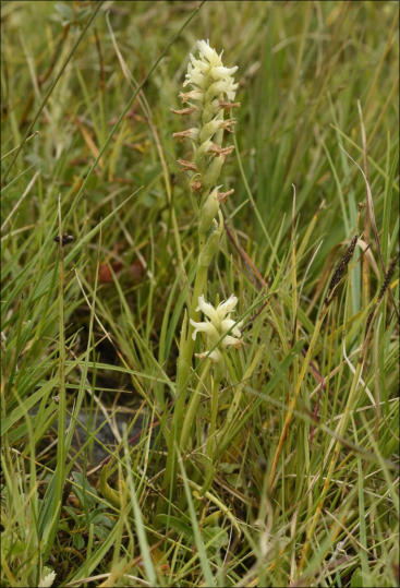
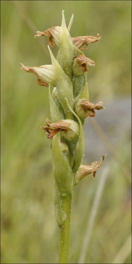
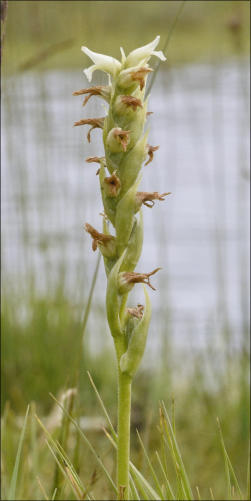
e) North shore of Errew Peninsula, W. Lough Conn. A difficult site with the orchids exposed to harsh north winds
and wave conditions. We were a bit late in getting around to checking them out this year and our count of 15 is
low for the area. We have had much higher numbers in other years. The Images RIGHT are from Errew and show a
a much battered Spiranthes but apparently showing the initiation of seed production. Many of the Spiranthes here
were in groups of 2 or 3 indicating, perhaps, that they are sprouting from a previously established enlarged root?
Habitats
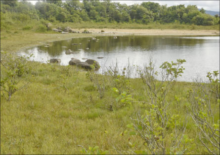
Sandy Bay has 3 distinct habitats, The Sandy
Beach and Marsh (RIGHT), the long barren
stretch of gently dipping bedded limestone
(FAR RIGHT) and the remote rugged karst
point to the north of the bay.
and Habits…
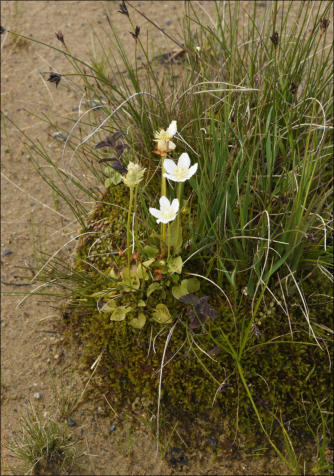
3 prominent beach species. Many species seek shelter
on raised ground in the beaches. Tussock (LEFT)
features the beautiful Grass of Parnasus Parnassia
palustris in a location often favoured by Spiranthes.
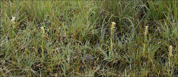
This wall of Spiranthes was typical of today’s research — pushed back into the densest vegetation
rising water levels could reach. This large area of back-strand was level with several deep pools
and meandering channels that reached into even the highest areas of vegetation and deep
quagmires. It shows how this plant seeds itself. Expected further new specimens along the main
channels and islands were not seen on this visit.
a) Cloghans Bay, E. Lough Conn
Cloghans Bay is in the northern half of L. Conn. It is a shallow meandering bay with a very extensive coastline. The coast is largely devoid of Spiranthes as it consists mainly of grassy islands and sloping wide shores. Despite its protection the area has only one significant colony of S. romanzoffiana on a headland jutting out into Cloghans Bay near the main fishing boat landing area.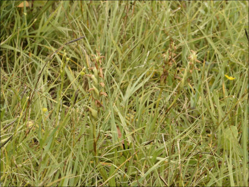
LEFT
One of the
larger
specimens in
grand isolation
at the water’s
edge at
Cloghans
ABOVE
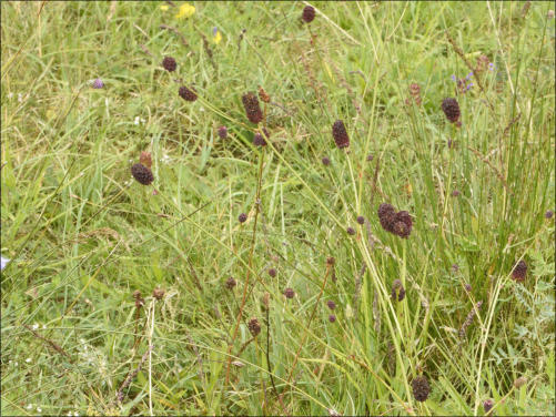
Great Burnet, Sanguisorba officinalis
This rare Irish plant is often associated with the wild places Spiranthes
enjoys. Must confess to overlooking its rarity and localised occurrence.
It flowers at the same time as the Spiranthes, is significantly taller, and
has very obvious red brown oval flowers
(BELOW RIGHT)
A barrage of
Spiranthes at the
furthest point the
seeds drifted into
the wetland.

Day 10 data:
DIARY Ref. No:
DAY and DATE
LOCATION
Weather
Water Level
SUMMARY
TOTAL SEEN
21romz/10a
Tues 24th Aug 1030 - 1215
Illanaghty, NE of Pontoon, L. Conn
Still and warm.
C 0.46
Stony scenic isolated area grazed by horses.
0
21romz/10b
do. 1245 - 1415
Enniscoe shoreline
Warm and Sunny.
do.
This is a stony shore with stones/flat grass.
0
21romz/10b
do. 1500 - 1700
Sawmill Point, Tonacrock
do.
do.
2nd visit. Not many new but interesting patterns!
13 extra (2nd Visit)
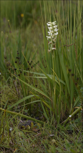
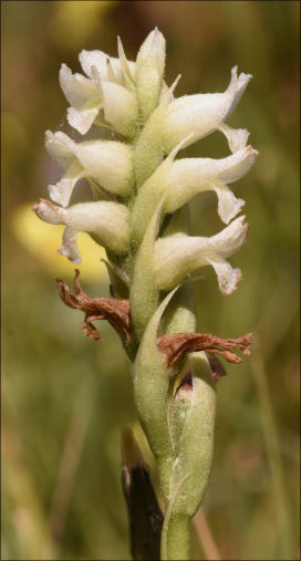
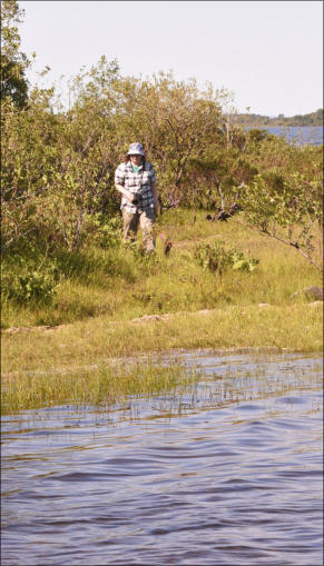
Frances
With warm acknowledgement to my dear
wife and muse and collaborator in all our
botanical trips. Here she is walking south
around one of two points heading south
towards Victoria Bay. Left & Right: Two of
the specimens she recorded there.

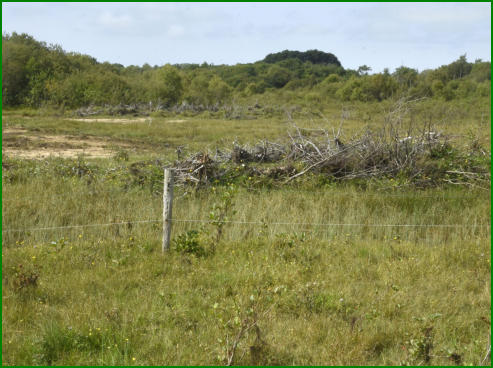

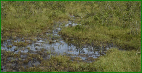
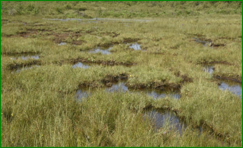
Day 11 data:
DIARY Ref. No:
DAY and DATE
LOCATION
Weather
Water Level
SUMMARY
TOTAL SEEN
21romz/11a
Thurs 26th Aug 1100 - 1230
Brackwansha - Sandy Bay, L. Conn
Cloudy and warm.
C 0.44
All peninsula walked, rocky shore, Sandy Bay marsh
0 (no new plants)
21romz11b
do. 1245 - 1445
The Lagoon, North Lough Conn
do.
do.
2nd visit, to photograph the damage further!
0 (no new plants)
21romz11c
do. 1600 - 1815
Bunduvowen, East L. Cullin
Warm and Sunny.
P 0.54
New site following literature ref. (2004)
2 (after much combing)
CLOCKWISE from LEFT:
Wall of Alders removed and flood entrance widened… Close-up of Alder bushes pulled up
and pushed to either side of habitat… Cattle now have access to what was once a closed
habitat… Settling ponds formerly lined by baby trees and S. romanzoffiana… a small pool
heavily trampled by cattle with green algae flourishing as a result… Finally, a remnant of the
former habitat (including 1 Spiranthes) in an area not yet destroyed by cattle or clearance.
Day 12 data:
DIARY Ref. No:
DAY and DATE
LOCATION
Weather
Water Level
SUMMARY
TOTAL SEEN
21romz/12a
Mon 30th Aug 1215 - 1310
Shore south of CP 1, L. Cullin
Mild and cloudy
P 0.50
Long grass (opp. end of beach to Nursery)
7 (new)
21romz/12b
do. 1315 - 1345
Car Park 1 north (The Nursery)
do.
do.
On open shore but many surviving and maturing!
- not counted today -
21romz/12c
do. 1350 - 1500
Visit 2 to new NW site L. Cullin
Warm and Sunny
do.
Many plants missing due to heat and Deer!
no additional records
21/romz12d
do. 1510 - 1545
NE corner Knockmore Bay, L. Conn
do.
C 0.38
A suitable site but not checked until now!
0
21/romz/12e
do. 1600 - 1715
Drummin Bay, new plants and seeding
do.
P 0.50
Some plants showing see development.
2 (additional records)
c) Bunduvowen, east side of L. Cullin
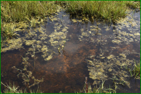
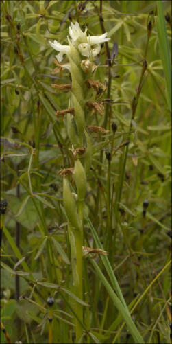
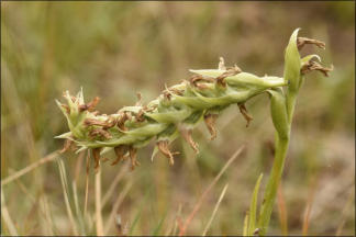
A small lake, a community, and a jagged coast onto L. Cullin, defines this area. It was identified from literature from the Royal Irish Academy c. 2004. The shoreline of the site is very suitable consisting of many small bays divided by rocky promontories. After much searching 2 specimens were found on the shore immediately north of Bunduvowen in a suitable marshy bay. They were a lucky find as we had combed the same area on the way out. Accordingly, permission was obtained to search a western shore from where the river enters the lake up to the point. A very interesting area and local help was very important but it seems we were probably too late. Plants were disappearing rapidly. This was the first indication that our survey for 2021 might be almost over… suddenly!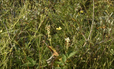
RIGHT
Not the best of
photographs but an
important one as we
are not sure there have
been any records for
this location since
2004.
It would seem to be an
ideal site with a variety
of habitats from short
grassy shores on sandy
bays to rocky alder
bays that this species
loves, to the edge of
flat wet fields and
marshes where they
can thrive if not grazed
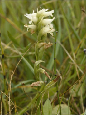
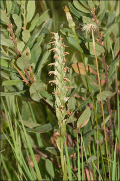
a) The 3 Car Parks at L. Cullin coming out from Foxford
These are 3 lovely beaches lining the road from Foxford to Pontoon
where it comes close to the north east shore of Lough Cullin. Perfect
for kids and weary adults to relax in peace and good clean water. In all
our traveling around Loughs Conn and Culllin we have never seen bad
water — always a pleasure to relax and work there. And that is not
something we would say about many more midland lakes!
As family people, with a water loving dog, we always have to be
careful that the waters we go to are safe for swimming in. And in
north Mayo, they always are. Of course there may be very occasional
instances of green algae pollution but never have we seen an
outbreak of the horrible and deadly cyanophyceae pollution that is
only too common elsewhere. So a big vote of confidence to Mayo
County Council and their Water Department.
However, our purpose in traveling all around these lakes is to observe
and record the orchid, Spiranthes romanzoffiana, as these lakes are
prime territory for this species. Happily, as this survey comes to an
end we can record our biggest ever count of this beautiful orchid, also
known as Irish Lady’s Tresses. Mayo could well be the European
Heartland for this unique species — indeed Ireland is the only Country
of the EU in which they occur and we probably have a larger
occurrence of the species than Scotland, its only other known haunt
this side of the Atlantic.
Something to be proud of…
… and we are but we should look after them — while we have them. Mayo could be a perfect conservation location for this species though it may, inevitably, migrate further north if Climate Change and global warming is not controlled. It can be our unique litmus test?b) The Botany of the 3 Lough Cullin car-parks.
Apart from the social and heritage value of a pure clean
and healthy environment to us, it does also allow plants
and wildlife to flourish as they have always done in a wild
and natural Ireland.
Interestingly these beaches do offer some singular
benefits — especially the place we call a Nursery —where
S. romanzoffiana seems most likely to produce seeds!
1.
At the upper edge of CP 1 (the first Carpark you will
meet coming from Foxford) there is a small flat area like
a tennis court but with many small trees (Alder) there.
These protect the Orchids and the Orchids protect the
beach. If a mistake happens and their habitat is
damaged the protection afforded to this very rare plant
can be invoked and any accidental damage done to their
habitat can be repaired. S. romanzoffiana is one of the
few plants in Ireland whose habitat is protected by law
— as is the species itself. Isn’t that amazing!
2.
It seems that people and this orchid can survive very
well together. We have often been amazed at how this
species can flourish in what can be a very busy
Summertime beach. It would seem obvious to fence and
ward off part of the shore but that might be counter-
productive?
3.
Further out in Drummin’s Bay (where very few people
go) there are a hundred more Spiranthes appearing and
flowering and reproducing every year unhindered by
mankind and cows! But secure fences are vital as we
have often seen hungry cows eyeing up the wet
shoreline and strand where the orchids thrive..
A damaged plant in The Nursery but it is recovering and growing
upwards and its roots, stem and seeds may still develop.
Lateral Buds (the oval shaped leaves) seen
here are the vegetative way this plant
survives — no seeds!
LEFT
An unusual variant. This
plant is producing buds and
flowers at every node when
it ‘should’ only have a
cluster at the tip of the
flowering stalk.
These occur about 1% of
the time at the end of the
season and is the result of
a simple genetic ‘error’
Other orchids would
naturally do this!
RIGHT
Another very healthy
plant from the Nursery
with a good length of
flowering stalk and still
green and very healthy.
We hope that this plant
might go on to develop
seeds if weather is good;
more information later.
RIGHT: On the mid west shore of L. Conn at Sawmill Point, there is another long gently curving
stony shoreline with a backdrop of Alders, Bog Myrtle and Royal Ferns — a typical Spiranthes
Habitat. This yielded some specimens but not as many as in earlier years. Like much of the west
shore of L. Conn this shore is now stony with fewer sandy/grassy patches for the orchid
(RIGHT)
A CLOSE-UP of Common Butterwort, a
perennial that has emerged in great
numbers in recent weeks on the flat sand.
Day 13 data:
DIARY Ref. No:
DAY and DATE
LOCATION
Weather
Water Level
SUMMARY
TOTAL SEEN
21romz/13a
Thurs 2nd Sept 1215 - 1310
Inishlee (Kidney Isl) NE Lough Conn
Sunny and warm
C 0.34
2nd visit. 1st outstanding; now grazed and damage…
0 (none new)
21romz13b
do. 1415 - 1545
Efforts to explore Victoria Bay
do.
do.
Unable to gain access.
not counted today
21/romz13c
do. 1600 - 1700
NE point of Bunduvowen,
do.
P 0.47
Very good habitat but too late in the year.
0
September, and into our final Recording trip…
The Summer has flown and it seems as if we have seen the last Spiranthes for 2021. Following our initial survey of the north shore of Bunduvowen (2) we got an opportunity (facilitated by landowner) to survey the wast facing coast north of the Bunduvowen River. A very suitable site, lightly grazed with numerous rocks and bushes for Spiranthes to hide under; but none were found! we acknowledge the work of earlier workers and the Irish Naturalist Journal in bringing this location to our attention. The precise location was not given so we had to rely on our experience in finding the plants. First day was successful; today was unsuccessful. This area will certainly be a priority of a less intense survey (We are getting old!) in 2022… b) Victoria Bay Names are a problem around Lough Conn and L. Cullin; how many of them are widely known nowadays? We are using this name to cover and area north of Massbrook Point and going up as far as Sawmill Point and the distinctively pointed bay near Tonacrock. All of that difficult coast has been walked at least once apart from a stony shore heading towards a fishing area and some holiday homes. This could have yielded 10 or 12 records but we had to abandon it today as access, without undertaking very long walks, was difficult. Also, the northern part of the shore, formerly good, only supported 7 specimens in about 3km of walking (there and back) so numbers missed were probably very small.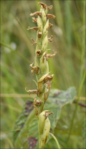
a) Inishlee, NE L. Conn, September…into our final Recording trip.
This is one of the areas around the Twin Lakes (Conn and Cullin) where we recorded over a hundred flowering S. romanzoffiana. These spectacular occurrences led to our largest every level of records. (21romz/5a) The area can be placed by Nephin looming across the lake and the little kidney shaped island and isthmus featuring off shore from two colonies of Spiranthes. Today was a return visit hoping to see many healthy fertile orchids still thriving — but a little pessimistic also.
Unfortunate loss of stock:
Inishlee is a salient pointer for two separate colonies of Spiranthes. The lower photo (RIGHT) shows the shoreline
and the hinterland behind it south of Inishlee. All this area from shore to large background bushes contained
many orchids. (See Day 5 above)
Sadly, all this shore, which had not been grazed (i.e. cattle had been excluded) until now, has become a sad zone
for the Spiranthes. Of the 135 found a month earlier only two could now be identified and both of these (BELOW)
were showing damage by grazing. Ideally, biodiversity and conservation should protect sustainable farming and
Nature; if only there was way this internationally significant extremely rare plant could be protected around the
Lakes! All it would take would be a selection of plots of land (1 or 2 Ha) around several parts of the Lakes to be
effectively protected year round — and for landowners to be supported — year round?
LEFT
Two stragglers from a large
colony of Spiranthes south of
Wherrew. These were all we
could find on our second visit
and damage to plants and site is
evident.
Both plants seem healthy and
there is no fatal damage done. If
left undisturbed they could go on
to develop seed especially with
the benign Summer/Autumn
Ireland is enjoying.
RIGHT
Inishlee Island
situated in NE Lough Conn is a
very low island but does (quite
likely) afford a degree of
protection to adjoining
shorelines north and south
even when the narrow
mainland connection is
flooded. Such shelter would
account for the shallow grassy
shores with only modest
boulders.
RIGHT
The main shore at Inishlee,
taken from north of the
isthmus showing both the
beach, the grassy area. and the
dense Alder growth that all
seemed to suit S.
romanzoffiana at the start of
the season.
However the shore is very
prone to species loss once
grazing is opened up and,
regretably, this implies full year
round protection as vegetative
reproduction is active from
now through to next Spring.
c) Bunduvowen Point…
Anxious and shy, at the same time, we were keen to complete the rest of the suitable Bunduvowen shoreline for
future recording! A warm welcome and some helpful guidelines soon had us on our way. Inevitably we spend a
lot of time trudging along stony shores — and we look on them as public access? But, sometimes you have to ask
for access. We were so delighted with the help from a local man in how to get there and… to mind the bull! Both
of which we adhered to and enjoyed a pleasant hour on a very suitable shore line which, we expect, at the right
time of the year might yield many healthy flowering Spiranthes. Today was too late but the knowledge and the
contacts makes our work so much easier. Thanks to all who have helped us!
The problem of dying orchids:
We have a policy of recording every orchid seen except where our records show us that a specimen could be
withing the tolerance of the GPS and, therefore, the same plant — even if it looks different to our memory. That
is why we try and visit every location at least twice a season and use tricks, like different coloured markers, to
differentiate plants seen on different days. Every plant that emerges is regarded as a record as long as it
emerged, was recognised, and was far enough from any other specimens to be sure it is a distinct plant. So, the
record from Inishlee will read 135 — even though only a few are left. Their roots and lateral buds are still in the
ground!
RIGHT
Further away
from the water
small groups of
mature plants
were clustered
together in much
heavier
vegetation of
Alder, Myrtle and
Great Burnet
Damage to ‘a Spiranthes habitat’ was first observed this year in a place we have christened as The Lagoon over the last several
years. It is north of the Deel River In Tolans Bay, an area that feels the brunt of southerly winds blowing up L. Conn. These lead to
bursts over the shore where it is not protected by an impregnable wall of Alders. The water used to enter through a very limited
channel and remained as a a wet lagoon for months afterwards.
Towards the end of August we visited a couple of known locations around Sandy Bay. But first a visit to Brackwansha a bit to the south — an area of lagoons, marshy
patches, and raised sandy banks — very like Sandy Bay and The Lagoon also visited today. After surveying Brackwansha a full coastal walk was made around the point
and along the north facing shore to a known site at the entrance to Sandy Bay where numbers were reducing. It’s a very arid and exposed karst site.
The small table below shows the numbers found every year
since site was identified:
Date:
Count:
Comment:
19 July 2018
142
1 visit; The best ever.
23 July 2019
38
The weather/visits
6 August 2020
58
A fairly healthy count for August
24 July2021
12
Much of site has been cleared!
It should be noted here that Spiranthes romanzoffiana (Irish Lady’s
Tresses) is a species protected by law under the Wildlife Act. It is not
allowed to damage or remove these plants or alter their Habitat. For
more information visit this NPWS Site. (National Parks and Wildlife
Service of Ireland.) Site Damage has been reported.
a) Brackwansha to Sandy Bay… the long way!
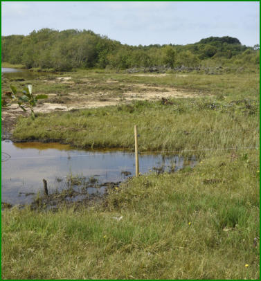
ABOVE: Back strand at Sandy Bay with Spiranthes lining flood ways.


21romz/12a and 21romz/12b
c) New NW site L. Cullin:
Today was our second visit to this site discovered on Day 7. Nothing more to add except that 2 more specimens were reported to us on the west side of the the stubby promontory jutting into L. Cullin. This is a very valuable addition to our collection of new habitats to facilitate early recording of emerging specimens in future years; late July is the time to get the bulk of field work done!e) Drummin Bay Spiranthes stronghold:
The team split up here with one working on monitoring existing flowers for possible signs of seed production and variants. It has been a disappointing year for sexual reproduction with no indisputable indications of seed production on a significant scale. Further research will be reported in the Autumn (in a different Page) comparing the numbers of seeding plants from 2018 and 2021. We look forward to getting this done. The other recorder simple studied the area outside the places where our previous large numbers were collected. 2 additional records were found using GPS to separate the old and the new records. These will be added to the Map and we hope to be soon able to produce a live map of the success of this species in Conn and Cullin in a GPX or JPG. format.d) Knockmore Bay, NE corner.
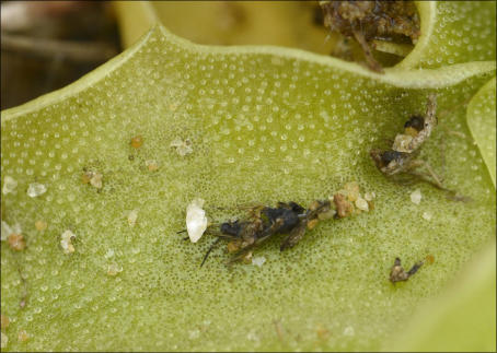
Whilst we have surveyed this bay thoroughly in all years we have missed this place where it seems there was a good collection of S. romanzoffiana in previous years. Indeed, it is a very suitable habitat and little disturbed apart from the pulling up of some shoreline Alder trees. No Spiranthes were found, just some interesting Invertebrates, one of which is shown below. Shark Moth Cucullia umbractica is a western species in Ireland particularly found in Mayo. The shark name comes from a shark fin shaped projection behind the head of the adult moth.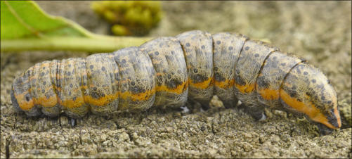
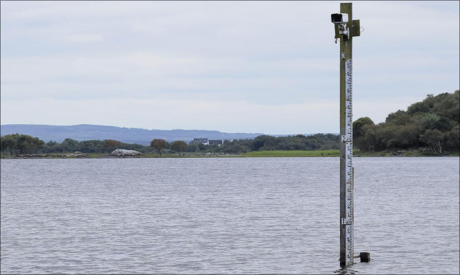
Water Gauges:
These large modern measuring devices situated in the lakes, or hidden
on their shores, or reported in the WaterLevel.ie website, show the
same information both in traditional pillars and, now, electronically.
They enable fishermen to plan safe trips and they are vital in advising
when rare plants and animals can be safely viewed. These gauges
measure the changing water level in metres above the base of the staff.
The height above sea level at any time can also be determined from the
above website. A very useful service, much appreciated!
b) Sandy Bay.
Middle of the east shore of L. Conn south of Cloghans, this is a very attractive diverse area with many interesting species and good numbers of Spiranthes
a) Illanaghty Shore: This pointed headland guards a large bay north east of
Pontoon. Formerly it provided a few Spiranthes, but none this year. However it is a
delightful habitat with its stony northern shoreline and tree clad islands and the
ever impressive Nephin looming in the background. A bit hard to get to but well
worth the effort on a sunny day with the water level low. Has many suitable niches
to harbour some Spiranthes but being a bit late in the season — with some very
active horses roaming over the whole area — probably explains the absence of Irish
Lady’s Tresses from this zone and many similar areas of the Twin Lakes.

These 4 images are all from Car Park 1. The plants are thriving!
b) North East Bay Lough Cullin Car Park 1 (south):
A detailed survey from Sandhouse Bay to Massbrook Point. The MAP we REFER to is available from Inland
Fisheries Ireland and it is a beautiful piece of work showing so many local names that can identify our orchid
sites. Only two specimens were recorded on this walk and the rough headland to the north.
c) Cuilkillew and Victoria Bay, north of previous site.
Again a disappointing survey with on 4 spotted. This was a wide flat area of grassland and ponds but affected by
low-level grazing and pulling up of Alder trees which were an important part of the shore. Not bouldery at all
and might have been suitable other factors excepted.
RIGHT


